- 0 replies
- 1,283 views
- Add Reply
- 0 replies
- 1,650 views
- Add Reply
- 0 replies
- 1,662 views
- Add Reply
- 0 replies
- 2,259 views
- Add Reply
- 2 replies
- 3,303 views
- Add Reply
Velodyne and Nikon announce agreement for production of LiDAR sensors

By Lurker,
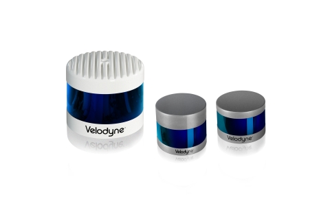
Velodyne Lidar, Inc has announced an agreement with Nikon Corporation, under which Sendai Nikon Corporation, a Nikon subsidiary, will manufacture LiDAR sensors for Velodyne with plans to start mass production in the second half of 2019. The partnership cements Velodyne’s manufacturing plan and expands its lead in the global LiDAR sensor market.
“Mass production of our high-performance lidar sensors is key to advancing Velodyne’s immediate plans to expand sales in North America
Harxon GNSS antennas for UAV
By Lurker,

Harxon is showcasing its full range of UAV antennas and technologies for various UAV applications — especially for UAV base stations — at AUVSI Xponential, being held April 30-May 2 in Chicago.
Harxon’s newly launched X-Survey antenna offers a 4-in-1 design for multi-constellation GNSS signal reception. It integrates Wi-Fi, Bluetooth and 4G modules for easy integration into real-time kinematic (RTK) systems.
It also ensures centimeter accuracy for precision positioning of UAVs, and st
Airbus and Orbital insight launch earth monitor to provide insights on geopolitical and economic
By Lurker,
Airbus Defence and Space and Orbital Insight have expanded upon their partnership agreement to create Earth Monitor, a powerful change analysis and insights service which provides situation awareness over archived or newly tasked areas of interest.
Earth Monitor, available through Airbus’ OneAtlas Platform, leverages Orbital Insight’s machine learning and computer vision expertise through powerful algorithms that detect changes in infrastructure and land use in near real-time, as well as id
Problem with analysis tool "Vehicle Routing Problem"

By mirellafaccini,
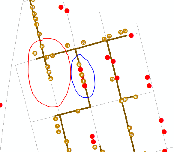
I'm working with route optimization for garbage collection in a city and using the VRP analysis tool.
For this I vectorized all the houses and inserted a field with the production of trash for each of them,
I have a shapefile of the ways and all its restrictions.
I'm finding some problems with the garbage truck returning in the middle of the road,
instead of going through its entire length (red circle).
In addition, the truck, when passing by a lane, collects only a portion of the existing g
First release of new product : ArcGIS Excalibur
By Lurker,
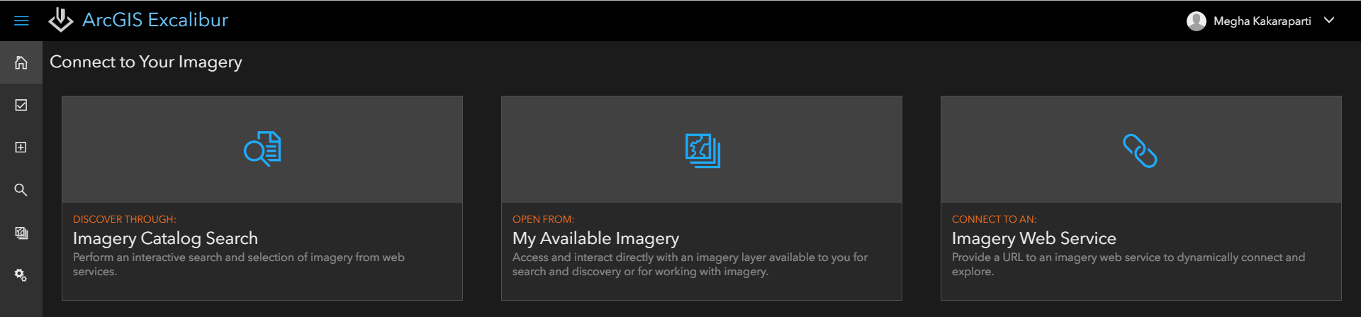
premium web application for ArcGIS Enterprise 10.7 that provides users with tools and capabilities in a project-based environment that streamlines image analysis and structure observation management.
Interested in working with imagery in a modern, web-based experience? Here’s a look at some of the features ArcGIS Excalibur 1.0 has to offer:
Search for Imagery
ArcGIS Excalibur makes it easy to search and discover imagery available to you within your organization through a number of
-
Forum Statistics
8.8k
Total Topics43.5k
Total Posts
-
Latest Posts
-
-

-
 Are you ready to level up your geospatial skills? Join our comprehensive training course covering ArcMap, ArcGIS Pro, and ArcOnline—the essential tools for modern spatial analysis and programming! What You’ll Learn: Core functionalities of ArcMap & ArcGIS Pro Cloud-based mapping with ArcGIS Online Automating workflows with Python & ModelBuilder Creating interactive web maps & apps Who Should Enroll? GIS beginners & professionals Urban planners, environmental scientists, & data analysts Developers looking to integrate spatial programming Why Choose This Course? Hands-on projects & real-world applications Expert-led sessions & flexible learning Limited slots available! Click here to register. Let’s shape the future of spatial data together!
 -
GPS is an incredible piece of modern technology. Not only does it allow for locating objects precisely anywhere on the planet, but it also enables the turn-by-turn directions we take for granted these days — all without needing anything more than a radio receiver and some software to decode the signals constantly being sent down from space. [Chris] took that last bit bit as somewhat of a challenge and set off to write a software-defined GPS receiver from the ground up. As GPS started as a military technology, the level of precision needed for things like turn-by-turn navigation wasn’t always available to civilians. The “coarse” positioning is only capable of accuracy within a few hundred meters, so this legacy capability is the first thing that [Chris] tackles here. It is pretty fast, though, with the system able to resolve a location in 24 seconds from cold start and then displaying its information in a browser window. Everything in this build is done in Python as well, meaning that it’s a great starting point for investigating how GPS works and for building other projects from there. The other thing that makes this project accessible is that the only other hardware needed besides a computer that runs Python is an RTL-SDR dongle. These inexpensive TV dongles ushered in a software-defined radio revolution about a decade ago when it was found that they could receive a wide array of radio signals beyond just TV. source: Hackaday and GitHub - chrisdoble/gps-receiver
-
-
Latest Topics
-
-
Recent Achievements


