- 0 replies
- 980 views
- Add Reply
- 0 replies
- 1,449 views
- Add Reply
- 0 replies
- 654 views
- Add Reply
- 0 replies
- 800 views
- Add Reply
- 0 replies
- 1,235 views
- Add Reply
Mathematicians debunk GPS assumptions to offer improvements

By Lurker,

The summer holidays are ending, which for many concludes with a long drive home and reliance on GPS devices to get safely home. But every now and then, GPS devices can suggest strange directions or get briefly confused about your location. But until now, no one knew for sure when the satellites were in a good enough position for the GPS system to give reliable direction.
TU/e's Mireille Boutin and her co-worker Gregor Kemper at the Technical University of Munich have turned to mathematics t
At least 30 dead after dam collapse disaster in Sudan
By Lurker,

At least 30 people have been killed following the collapse of a dam in Sudan's northwest Red Sea State, according to the United Nations's emergency relief agency. Hundreds more are believed missing, Reuters reported.
Flash flooding decimated 20 villages and damaged a further 50 after the Arba'at Dam collapsed Sunday, the United Nations Office for the Coordination of Humanitarian Affairs (OCHA) said. It estimated 50,000 people had been "severely affected" by the disaster.
In the villages of K
UAE among top 20 countries operating SAR satellites with launch of 'Foresight-1'
By Lurker,
Bayanat, a leading provider of AI-powered geospatial solutions and a subsidiary of G42, confirmed that the launch of the Synthetic Aperture Radar (SAR) satellite, titled "Foresight-1", is a significant achievement that reinforces the UAE's global leadership in the space sector, as it is the first satellite of the UAE's Earth Observation Space Programme.
Hasan Al Hosani, Managing Director of Bayanat, told the Emirates News Agency (WAM) that Foresight-1 places the UAE among the prestigious li
Sentinel-2C in the Vega launch tower
By Lurker,

In preparation for liftoff on 4 September 2024 (3 September Kourou time), the Vega–Sentinel-2C upper-composite has been hoisted into the launch tower at Europe’s Spaceport.
The Sentinel-2 mission is based on a constellation of two identical satellites, Sentinel-2A (launched in 2015) and Sentinel-2B (launched in 2017), flying in the same orbit but 180° apart to optimise coverage and revisit time.
Each satellite carries a high-resolution multispectral imager to deliver optical images fro
Images from UK military’s first satellite will be shared with allies
By Lurker,
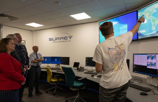
Images gathered by the UK military’s first satellite will be shared with allies, the Ministry of Defence (MoD) has said.
The department said the war in Ukraine had shown that the use of space is “crucial” to military operations.
The satellite, named Tyche, was launched on Friday from a rocket owned by SpaceX, the company co-founded by technology entrepreneur and billionaire Elon Musk.
Along with military information, it is intended that data from the satellite will be accessible b
-
Forum Statistics
8.8k
Total Topics43.5k
Total Posts
-
Latest Posts
-
 Are you ready to level up your geospatial skills? Join our comprehensive training course covering ArcMap, ArcGIS Pro, and ArcOnline—the essential tools for modern spatial analysis and programming! What You’ll Learn: Core functionalities of ArcMap & ArcGIS Pro Cloud-based mapping with ArcGIS Online Automating workflows with Python & ModelBuilder Creating interactive web maps & apps Who Should Enroll? GIS beginners & professionals Urban planners, environmental scientists, & data analysts Developers looking to integrate spatial programming Why Choose This Course? Hands-on projects & real-world applications Expert-led sessions & flexible learning Limited slots available! Click here to register. Let’s shape the future of spatial data together!
 -
GPS is an incredible piece of modern technology. Not only does it allow for locating objects precisely anywhere on the planet, but it also enables the turn-by-turn directions we take for granted these days — all without needing anything more than a radio receiver and some software to decode the signals constantly being sent down from space. [Chris] took that last bit bit as somewhat of a challenge and set off to write a software-defined GPS receiver from the ground up. As GPS started as a military technology, the level of precision needed for things like turn-by-turn navigation wasn’t always available to civilians. The “coarse” positioning is only capable of accuracy within a few hundred meters, so this legacy capability is the first thing that [Chris] tackles here. It is pretty fast, though, with the system able to resolve a location in 24 seconds from cold start and then displaying its information in a browser window. Everything in this build is done in Python as well, meaning that it’s a great starting point for investigating how GPS works and for building other projects from there. The other thing that makes this project accessible is that the only other hardware needed besides a computer that runs Python is an RTL-SDR dongle. These inexpensive TV dongles ushered in a software-defined radio revolution about a decade ago when it was found that they could receive a wide array of radio signals beyond just TV. source: Hackaday and GitHub - chrisdoble/gps-receiver
-
-

-
-
Latest Topics
-
-
Recent Achievements
-


")


