- 0 replies
- 963 views
- Add Reply
- 0 replies
- 1,260 views
- Add Reply
- 0 replies
- 640 views
- Add Reply
- 0 replies
- 772 views
- Add Reply
- 0 replies
- 1,215 views
- Add Reply
Mathematicians debunk GPS assumptions to offer improvements

By Lurker,

The summer holidays are ending, which for many concludes with a long drive home and reliance on GPS devices to get safely home. But every now and then, GPS devices can suggest strange directions or get briefly confused about your location. But until now, no one knew for sure when the satellites were in a good enough position for the GPS system to give reliable direction.
TU/e's Mireille Boutin and her co-worker Gregor Kemper at the Technical University of Munich have turned to mathematics t
At least 30 dead after dam collapse disaster in Sudan
By Lurker,

At least 30 people have been killed following the collapse of a dam in Sudan's northwest Red Sea State, according to the United Nations's emergency relief agency. Hundreds more are believed missing, Reuters reported.
Flash flooding decimated 20 villages and damaged a further 50 after the Arba'at Dam collapsed Sunday, the United Nations Office for the Coordination of Humanitarian Affairs (OCHA) said. It estimated 50,000 people had been "severely affected" by the disaster.
In the villages of K
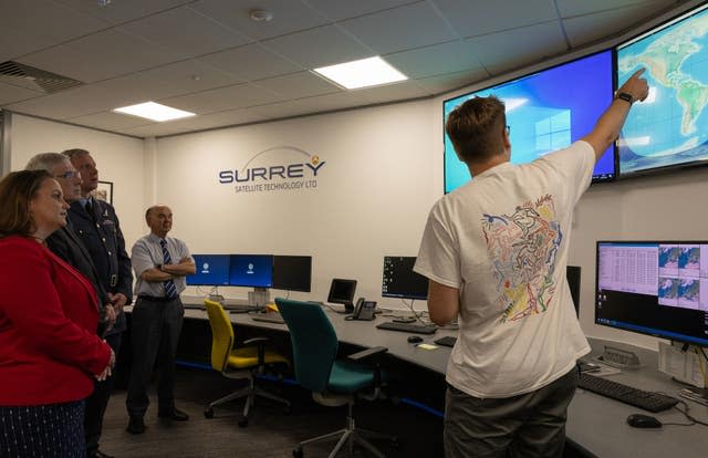
UAE among top 20 countries operating SAR satellites with launch of 'Foresight-1'
By Lurker,
Bayanat, a leading provider of AI-powered geospatial solutions and a subsidiary of G42, confirmed that the launch of the Synthetic Aperture Radar (SAR) satellite, titled "Foresight-1", is a significant achievement that reinforces the UAE's global leadership in the space sector, as it is the first satellite of the UAE's Earth Observation Space Programme.
Hasan Al Hosani, Managing Director of Bayanat, told the Emirates News Agency (WAM) that Foresight-1 places the UAE among the prestigious li
Sentinel-2C in the Vega launch tower
By Lurker,

In preparation for liftoff on 4 September 2024 (3 September Kourou time), the Vega–Sentinel-2C upper-composite has been hoisted into the launch tower at Europe’s Spaceport.
The Sentinel-2 mission is based on a constellation of two identical satellites, Sentinel-2A (launched in 2015) and Sentinel-2B (launched in 2017), flying in the same orbit but 180° apart to optimise coverage and revisit time.
Each satellite carries a high-resolution multispectral imager to deliver optical images fro
Images from UK military’s first satellite will be shared with allies
By Lurker,
Images gathered by the UK military’s first satellite will be shared with allies, the Ministry of Defence (MoD) has said.
The department said the war in Ukraine had shown that the use of space is “crucial” to military operations.
The satellite, named Tyche, was launched on Friday from a rocket owned by SpaceX, the company co-founded by technology entrepreneur and billionaire Elon Musk.
Along with military information, it is intended that data from the satellite will be accessible b
-
Forum Statistics
8.7k
Total Topics43.5k
Total Posts
-
Latest Posts
-
-

-
NASA and the Italian Space Agency made history on March 3 when the Lunar GNSS Receiver Experiment (LuGRE) became the first technology demonstration to acquire and track Earth-based navigation signals on the Moon’s surface. The LuGRE payload’s success in lunar orbit and on the surface indicates that signals from the GNSS (Global Navigation Satellite System) can be received and tracked at the Moon. These results mean NASA’s Artemis missions, or other exploration missions, could benefit from these signals to accurately and autonomously determine their position, velocity, and time. This represents a steppingstone to advanced navigation systems and services for the Moon and Mars. “On Earth we can use GNSS signals to navigate in everything from smartphones to airplanes,” said Kevin Coggins, deputy associate administrator for NASA’s SCaN (Space Communications and Navigation) Program. “Now, LuGRE shows us that we can successfully acquire and track GNSS signals at the Moon. This is a very exciting discovery for lunar navigation, and we hope to leverage this capability for future missions.” The road to the historic milestone began on March 2 when the Firefly Aerospace’s Blue Ghost lunar lander touched down on the Moon and delivered LuGRE, one of 10 NASA payloads intended to advance lunar science. Soon after landing, LuGRE payload operators at NASA’s Goddard Space Flight Center in Greenbelt, Maryland, began conducting their first science operation on the lunar surface. With the receiver data flowing in, anticipation mounted. Could a Moon-based mission acquire and track signals from two GNSS constellations, GPS and Galileo, and use those signals for navigation on the lunar surface? Then, at 2 a.m. EST on March 3, it was official: LuGRE acquired and tracked signals on the lunar surface for the first time ever and achieved a navigation fix — approximately 225,000 miles away from Earth. Now that Blue Ghost is on the Moon, the mission will operate for 14 days providing NASA and the Italian Space Agency the opportunity to collect data in a near-continuous mode, leading to additional GNSS milestones. In addition to this record-setting achievement, LuGRE is the first Italian Space Agency developed hardware on the Moon, a milestone for the organization. The LuGRE payload also broke GNSS records on its journey to the Moon. On Jan. 21, LuGRE surpassed the highest altitude GNSS signal acquisition ever recorded at 209,900 miles from Earth, a record formerly held by NASA’s Magnetospheric Multiscale Mission. Its altitude record continued to climb as LuGRE reached lunar orbit on Feb. 20 — 243,000 miles from Earth. This means that missions in cislunar space, the area of space between Earth and the Moon, could also rely on GNSS signals for navigation fixes. source: NASA
-
 Dear, could someone share again the link to download this soft please. best regards,
-
-
Latest Topics
-
-
Recent Achievements
-


")


