- 1 reply
- 1,573 views
- Add Reply
- 0 replies
- 1,264 views
- Add Reply
- 7 replies
- 7,046 views
- Add Reply
- 1 reply
- 1,674 views
- Add Reply
- 2 replies
- 1,554 views
- Add Reply
GlobalMapper 21.1 WFS GML problem

By Capricorn,
Hi people,
When I connect to a WFS from GlobalMapper 21.1, a GML file with swapped coordinates is downloaded (northing-easting) and GlobalMapper reads these coordinates as they are easting-northing. Is there any workaround for this?
ArcMap reads this WFS normally using Interoperability Extension without telling SRS axis order. GlobalMapper doesn't have any option to chose SRS axis order.
U-blox technology platforms support BeiDou-3

By Lurker,
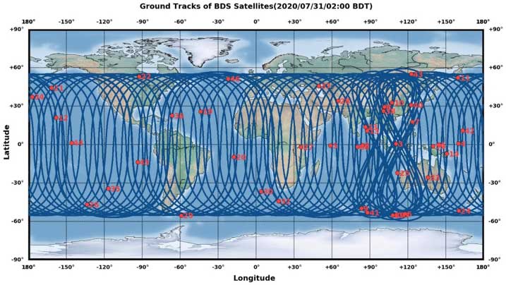
Current u-blox GNSS platforms — from u-blox M8 and beyond — support the recently completed BeiDou navigation satellite system modernizations, improving the availability of GNSS positioning services.
The opening ceremony of the BeiDou-3 global navigation satellite system (GNSS) was held in Beijing on July 31, officially celebrating the expansion of coverage offered by the critical Chinese space infrastructure to a global user base.
As a global supplier of GNSS positioning and wireless c
arcgis pro or arcmap?

By intertronic,
hello everyone,
I'm a long time user of arcmap and already two years ago on my computer I installed arcgis pro... now I don't know for you but I'm postponing for years the real switch between versions and I'm still on arcmap...
this because it seems to me that even if the expectations were very high, arcgis pro still doesn't seem to have that much declaimed performance. In particular, I'm concerned about the fact that for every little thing, it starts a geoprocessing that lasts between s
Introducing ArcGIS Living Atlas Indicators of the Planet
By Lurker,
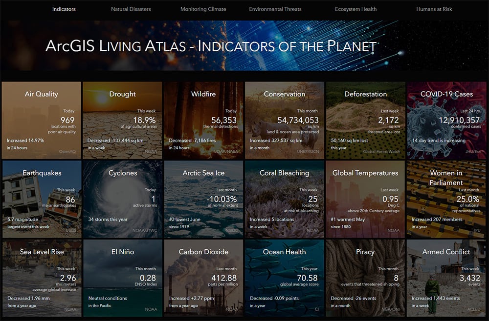
It was just announced that June was the 3rd hottest on record, Johns Hopkins put the number of COVID-19 cases at 13-million, and over 300,000 sq km of protected areas were created last month. These are all indicators of the planet’s vitality, but traditionally you’d need to bookmark three different websites to keep track of these and other metrics.
In partnership with Microsoft, National Geographic, and the United Nations Sustainable Development Solutions Network, Esri is gathe
Mapping the Causes of Mangrove Loss
By Lurker,

A joint NASA-USGS initiative has created the first worldwide map of the causes of change in mangrove habitats between 2000 and 2016. Mangrove trees can be found growing in the salty mud along the Earth’s tropical and subtropical coastlines. Mangroves are vital to aquatic ecosystems due to their ability to prevent soil erosion and store carbon. Mangroves also provide critical habitat to multiple marine species such as algae, barnacles, oysters, sponges, shrimp, crabs, and lobsters.
Mangroves
-
Forum Statistics
8.8k
Total Topics43.5k
Total Posts
-
Latest Posts
-
 Are you ready to level up your geospatial skills? Join our comprehensive training course covering ArcMap, ArcGIS Pro, and ArcOnline—the essential tools for modern spatial analysis and programming! What You’ll Learn: Core functionalities of ArcMap & ArcGIS Pro Cloud-based mapping with ArcGIS Online Automating workflows with Python & ModelBuilder Creating interactive web maps & apps Who Should Enroll? GIS beginners & professionals Urban planners, environmental scientists, & data analysts Developers looking to integrate spatial programming Why Choose This Course? Hands-on projects & real-world applications Expert-led sessions & flexible learning Limited slots available! Click here to register. Let’s shape the future of spatial data together!
 -
GPS is an incredible piece of modern technology. Not only does it allow for locating objects precisely anywhere on the planet, but it also enables the turn-by-turn directions we take for granted these days — all without needing anything more than a radio receiver and some software to decode the signals constantly being sent down from space. [Chris] took that last bit bit as somewhat of a challenge and set off to write a software-defined GPS receiver from the ground up. As GPS started as a military technology, the level of precision needed for things like turn-by-turn navigation wasn’t always available to civilians. The “coarse” positioning is only capable of accuracy within a few hundred meters, so this legacy capability is the first thing that [Chris] tackles here. It is pretty fast, though, with the system able to resolve a location in 24 seconds from cold start and then displaying its information in a browser window. Everything in this build is done in Python as well, meaning that it’s a great starting point for investigating how GPS works and for building other projects from there. The other thing that makes this project accessible is that the only other hardware needed besides a computer that runs Python is an RTL-SDR dongle. These inexpensive TV dongles ushered in a software-defined radio revolution about a decade ago when it was found that they could receive a wide array of radio signals beyond just TV. source: Hackaday and GitHub - chrisdoble/gps-receiver
-
-

-
-
Latest Topics
-
-
Recent Achievements


