- 0 replies
- 1,313 views
- Add Reply
- 0 replies
- 2,020 views
- Add Reply
- 0 replies
- 1,228 views
- Add Reply
- 0 replies
- 1,778 views
- Add Reply
- 0 replies
- 843 views
- Add Reply
US government adds DJI to Commerce blacklist over ties to Chinese government

By Lurker,
DJI — one of the largest and most popular drone companies in the world — has been added to the US Department of Commerce’s Entity List, designating the Chinese company as a national security concern and banning US-based companies from exporting technology to the company.
DroneDJ first reported the news, which was confirmed by Reuters based on a conference call with a senior commerce official. The Department of Commerce referred questions to the Federal Register listing. DJI declined to comm
DJI releases new Mavic 2 Enterprise Advanced
By Lurker,
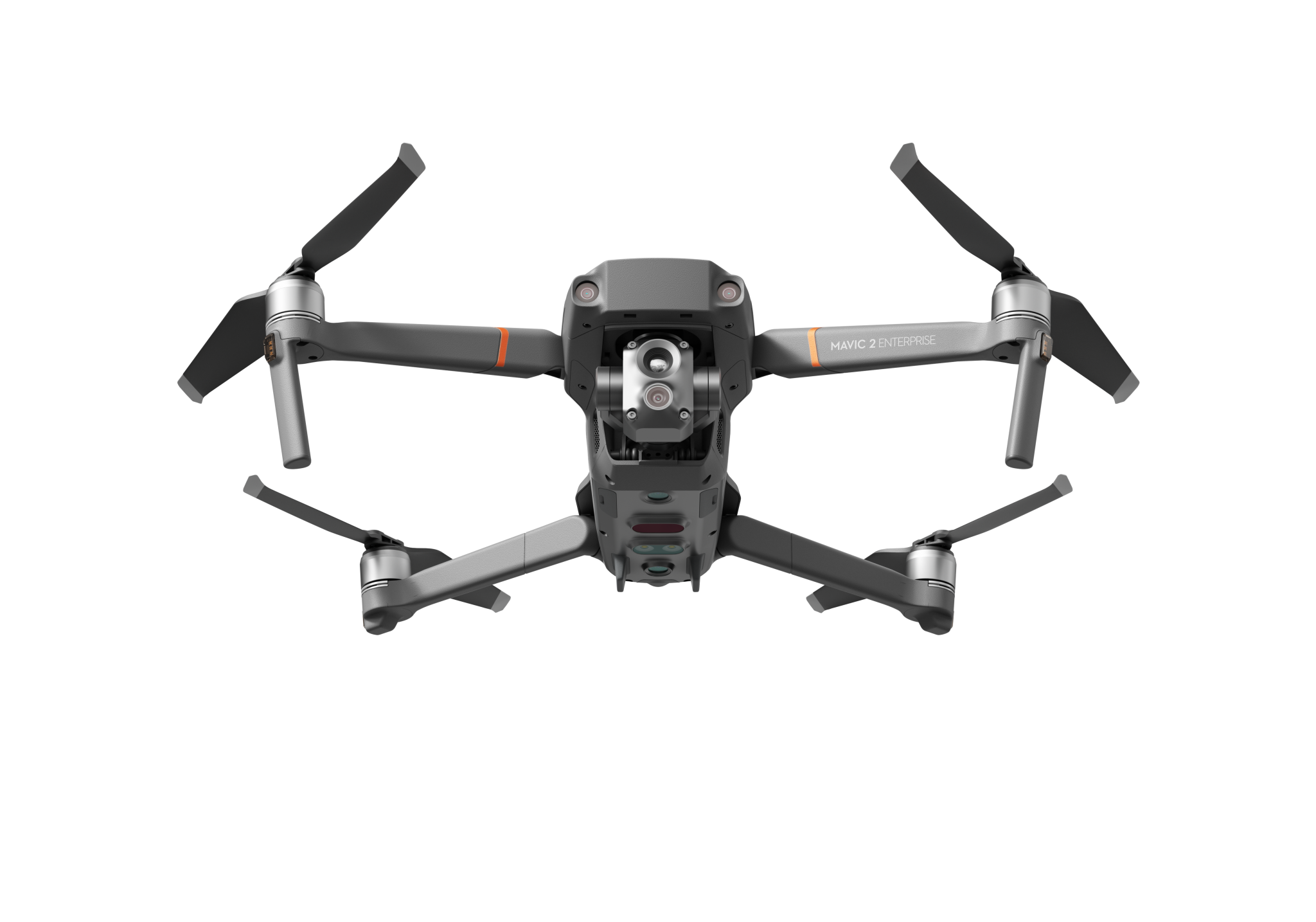
There’s a new member of DJI’s Enterprise line of drones. It’s the Mavic 2 Enterprise Advanced, and it features a new 32X camera, a DJI-produced thermal sensor, and a Real-Time Kinematic module for centimeter-level accuracy.
The new model comes a little more than two years after DJI released its Mavic 2 Enterprise, which proved a very popular drone with First Responders – ranging from lifeguards to law enforcement to Search and Rescue teams. It was that drone which heralded the modular desig
Mapping Sea-Level Rise with Sentinel-6
By Lurker,

On November 21st, Sentinel-6 was launched by the European Space Agency (ESA) using a SpaceX Falcon 9 rocket. The satellite was developed in partnership with NASA and other agencies and was named after former NASA Earth Science Division Director Michael Freilich.[1]
The recent launch of Sentinel-6 Michael Freilich/Jason CS is the latest mission that will collect sea level measurements at more frequent intervals to monitor the effects of climate change on our oceans. With one of the biggest
#Ask : FLO2D on QGIS plugin for urban flood

By rredy,
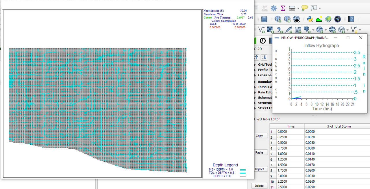
I'm currently learn to build urban flood model using FLO2D plugin on QGIS. It's running well when using sampel data. But when I try to build model with my own data it doesn't work. I'm stuck on detailed graphic process for flood. I even tried to make a model by slightly changing the boundary from sampel data to looking for the error, but it's not work again like before. I learn from this tutorial. For additional information, I posting screenshot when doing the process
1. Samp
Greenland ice sheet faces irreversible melting
By Lurker,
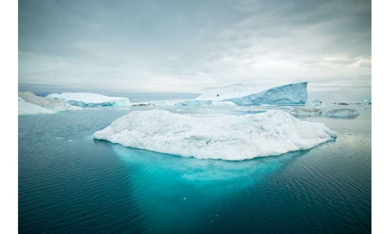
In a study published this week in The Cryosphere, researchers from the National Centre for Atmospheric Science and University of Reading demonstrate how climate change could lead to irreversible sea level rise as temperatures continue to rise and the Greenland ice sheet continues to decline.
The massive ice sheet faces a point of no return, beyond which it will no longer fully regrow, permanently changing sea levels around the world.
The Greenland ice sheet is seven times the area of t
-
Forum Statistics
8.8k
Total Topics43.5k
Total Posts
-
Latest Posts
-
 Are you ready to level up your geospatial skills? Join our comprehensive training course covering ArcMap, ArcGIS Pro, and ArcOnline—the essential tools for modern spatial analysis and programming! What You’ll Learn: Core functionalities of ArcMap & ArcGIS Pro Cloud-based mapping with ArcGIS Online Automating workflows with Python & ModelBuilder Creating interactive web maps & apps Who Should Enroll? GIS beginners & professionals Urban planners, environmental scientists, & data analysts Developers looking to integrate spatial programming Why Choose This Course? Hands-on projects & real-world applications Expert-led sessions & flexible learning Limited slots available! Click here to register. Let’s shape the future of spatial data together!
 -
GPS is an incredible piece of modern technology. Not only does it allow for locating objects precisely anywhere on the planet, but it also enables the turn-by-turn directions we take for granted these days — all without needing anything more than a radio receiver and some software to decode the signals constantly being sent down from space. [Chris] took that last bit bit as somewhat of a challenge and set off to write a software-defined GPS receiver from the ground up. As GPS started as a military technology, the level of precision needed for things like turn-by-turn navigation wasn’t always available to civilians. The “coarse” positioning is only capable of accuracy within a few hundred meters, so this legacy capability is the first thing that [Chris] tackles here. It is pretty fast, though, with the system able to resolve a location in 24 seconds from cold start and then displaying its information in a browser window. Everything in this build is done in Python as well, meaning that it’s a great starting point for investigating how GPS works and for building other projects from there. The other thing that makes this project accessible is that the only other hardware needed besides a computer that runs Python is an RTL-SDR dongle. These inexpensive TV dongles ushered in a software-defined radio revolution about a decade ago when it was found that they could receive a wide array of radio signals beyond just TV. source: Hackaday and GitHub - chrisdoble/gps-receiver
-
-

-
-
Latest Topics
-
-
Recent Achievements


