- 1 reply
- 1,734 views
- Add Reply
- 4 replies
- 2,017 views
- Add Reply
- 7 replies
- 12,108 views
- Add Reply
- 3 replies
- 1,779 views
- Add Reply
- 5 replies
- 3,407 views
- Add Reply
CHC Releases the LT400 Submeter GPS/GIS Data Collector

By Lurker,


CHC introduces the LT400, a compact, rugged and cost-effective handheld submeter real-time GPS receiver for GIS and Mapping Professionals. The LT400 is the ideal GIS hardware solution ready for use with third-party GIS software applications answering to a wide range of applications such as forestry, utilities and agriculture…
Designed for real-world field conditions, LT400 combines 3.7" full VGA sunlight readable display, powerful 806 MHz processor, all-day battery life and a professional high
Pansharpened SPOT image is blurry
By samrae,
This topic is just out of interest, but something strange happened when I tried to pansharpen (resolution merge) with ERDAS IMAGINE.
The SPOT 5 panchromatic and multispectral bands seemed to be slightly out of alignment, and result was a blurry output! I suspect its a data supplier issue. It also happened to someone in our department working in a different area, same data supplier and same software. I havent experimented with any other software yet.
Thankfully, the pansharpened image is
NDVI values from SPOT imagery
By samrae,
Hi, I've used 2011 SPOT-5 data to create an NDVI using ERDAS IMAGINE (the NDVI function available on the Raster toolbar).
Ive got the output but am slightly concerned with the values. Its a rural area that consists of pine plantation(stretching from the south-west) , tea plantation (south-east corner) and natural forest (amongst plantation), but the highest NDVI value is 0.206. The forest, pine plantation and water seem to read this value or lower (to 0.128).
1. Is water meant to measure s
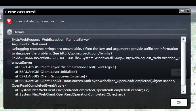
Arcgis for Silverlight error loading maps from arcgis server

By yizua,


i started using Arcgis for silverlight lately, but i still confuse why i keep getting error loading my map from arcgis server
here's the screenshot of error i received
:huh: :huh:
Any clues here pls??
Hotspot Analysis Tool in ArcGIS 10
By engineerup,


Hi all,
Whenever I try to run the Hot Spot Analysis (Getis-Ord Gi*) tool, I find an error icon of red circle with a cross inside, on the extreme top left and next to the Input Feature Class. The circle is found as soon as the tool window opens and even before I put in anything.
If I ignore this icon, put int eh required parameters and click OK, an error window appears, just containing a yellow triangle with an exclamation mark inside.
http://i1058.photobucket.com/albums/t403/essenti
-
Forum Statistics
8.8k
Total Topics43.5k
Total Posts


