- 0 replies
- 2,172 views
- Add Reply
- 1 reply
- 2,071 views
- Add Reply
- 0 replies
- 6,137 views
- Add Reply
- 0 replies
- 1,073 views
- Add Reply
- 0 replies
- 3,018 views
- Add Reply
35 Differences Between ArcGIS Pro and QGIS 3

By Lurker,
Six years ago, we compared ArcGIS vs QGIS. The response was incredible and we thank you for that.
But since then, the game has changed. Yet, the players are still the same.
The Omen of Open Source GIS is back with QGIS 3. It’s up against the Pioneer of Proprietary GIS, ArcGIS Pro.
Buckle up.
Because today, you’re going to witness a head-to-head battle between the juggernauts of GIS software.
Pick your poison.
Table of Contents
1. 3D
2. Interfac
The Critical Role of Geospatial Data Accuracy
By Lurker,
When it comes to choosing the right geospatial data for any project, many factors come into play—cost, convenience, consistency, and resolution, to name a few. Depending on the application, these factors can outweigh one another in importance.
Above all, one critical factor to never overlook is accuracy. Data accuracy is the degree to which information on a map matches real-world values. When it comes to geographic information systems (GIS) and artificial intelligence (AI) applications, po
Android phones now show earthquake alerts in Greece and New Zealand
By Lurker,
In the middle of last year, Google announced that it was turning Android phones into an early earthquake alert system. The system was first deployed in California which already has a sophisticated network of seismometers in place. In California, the Android Earthquake Alerts System disseminated alerts from the existing ShakeAlert system, but in regions that don’t have seismometer networks, Google said that users could opt in to turn their Android phone into a mini seismometer. Today, Google has
UC San Diego engineering professor solves deep earthquake mystery
By Lurker,
These mysterious earthquakes originate between 400 and 700 kilometers below the surface of the Earth and have been recorded with magnitudes up to 8.3 on the Richter scale.
Xanthippi Markenscoff, a distinguished professor in the Department of Mechanical and Aerospace Engineering at the UC San Diego Jacobs School of Engineering, is the person who solved this mystery. Her paper "Volume collapse instabilities in deep earthquakes: a shear source nucleated and driven by pressure" appears in the J
Deepfake tech takes on satellite maps
By Lurker,
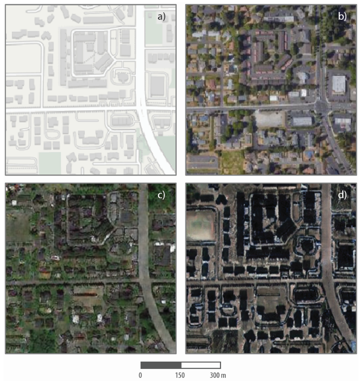
While the concept of “deepfakes,” or AI-generated synthetic imagery, has been decried primarily in connection with involuntary depictions of people, the technology is dangerous (and interesting) in other ways as well. For instance, researchers have shown that it can be used to manipulate satellite imagery to produce real-looking — but totally fake — overhead maps of cities.
The study, led by Bo Zhao from the University of Washington, is not intended to alarm anyone but rather to show the ri
-
Forum Statistics
8.8k
Total Topics43.5k
Total Posts
-
Latest Posts
-
 Are you ready to level up your geospatial skills? Join our comprehensive training course covering ArcMap, ArcGIS Pro, and ArcOnline—the essential tools for modern spatial analysis and programming! What You’ll Learn: Core functionalities of ArcMap & ArcGIS Pro Cloud-based mapping with ArcGIS Online Automating workflows with Python & ModelBuilder Creating interactive web maps & apps Who Should Enroll? GIS beginners & professionals Urban planners, environmental scientists, & data analysts Developers looking to integrate spatial programming Why Choose This Course? Hands-on projects & real-world applications Expert-led sessions & flexible learning Limited slots available! Click here to register. Let’s shape the future of spatial data together!
 -
GPS is an incredible piece of modern technology. Not only does it allow for locating objects precisely anywhere on the planet, but it also enables the turn-by-turn directions we take for granted these days — all without needing anything more than a radio receiver and some software to decode the signals constantly being sent down from space. [Chris] took that last bit bit as somewhat of a challenge and set off to write a software-defined GPS receiver from the ground up. As GPS started as a military technology, the level of precision needed for things like turn-by-turn navigation wasn’t always available to civilians. The “coarse” positioning is only capable of accuracy within a few hundred meters, so this legacy capability is the first thing that [Chris] tackles here. It is pretty fast, though, with the system able to resolve a location in 24 seconds from cold start and then displaying its information in a browser window. Everything in this build is done in Python as well, meaning that it’s a great starting point for investigating how GPS works and for building other projects from there. The other thing that makes this project accessible is that the only other hardware needed besides a computer that runs Python is an RTL-SDR dongle. These inexpensive TV dongles ushered in a software-defined radio revolution about a decade ago when it was found that they could receive a wide array of radio signals beyond just TV. source: Hackaday and GitHub - chrisdoble/gps-receiver
-
-

-
-
Latest Topics
-
-
Recent Achievements


