- 0 replies
- 996 views
- Add Reply
- 4 replies
- 2,145 views
- Add Reply
- 13 replies
- 5,543 views
- Add Reply
- 4 replies
- 7,005 views
- Add Reply
- 2 replies
- 1,908 views
- Add Reply
MODIS LST in wetland studies
By mshakir,
First of all i would say sorry to all the colleagues, maybe you find my topic irrelevant to GIS, I want to know can we use MODIS land surface temperature in wetland studies? My question in more concentrated form will be can modis satellite product LST give us the exact LST of the area which are submerged under water?
[Ask] CAD .dwg support for ArcGIS
By zetyxion,

anybody can help me, how to enable editing dwg data in arcgis 9.3? i've successfully export into layer, but can't editing .shp data inside it (polygon,polyline,point, etc.) because i can't use autoCADs software products. too many tools that make me confused although i have one installed on my notebook ( AutoCAD Map 2014) . but it's just for open file i'm asked about, and don't know how to do the things as i have to do at arcgis.
or if there's an application/extension which could enable ed
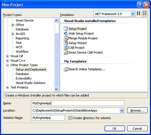
How to deploy an ArcGIS Engine application using a setup project

By yousef2233,


How to deploy an ArcGIS Engine application using a setup project
Summary:
This topic shows how to deploy an ArcGIS Engine application by creating a setup project in Visual Studio. In this topic
Requirements for deploying an ArcGIS Engine application using a setup project
Creating the setup project and setting properties
Adding application files to the setup project
Setting the default installation location
Creating a shortcut on the user's program menu
Adding launch conditions
Testi
Need Help..LandCover change detection using Envi

By am2,
Hi every one,
I am new with remote sensing and I want to extract landcover change during a time period.I have downloaded landsat 7 images and georefrenced them using a topography map.Now I want to step forward..But I dont know what to do?I have to classify each image now?or sth else?
What about using NDVI in case of show changes?Can you help me?and give me some good hints or resources in case of landcover change detection?
Thanks a lot
Aquatic Vegetation Mapping.
By achoknyz,
Looking for a clear methodology on how to map aquatic vegetation using landsat data.
Any info provided will be highly appreciated
Regards
-
Forum Statistics
8.7k
Total Topics43.4k
Total Posts


