- 7 replies
- 3,286 views
- Add Reply
- 3 replies
- 3,625 views
- Add Reply
- 0 replies
- 4,880 views
- Add Reply
- 0 replies
- 1,135 views
- Add Reply
landslide detection ruleset

By terefice,

hi every body
i want detection and monitoring landslid via ecognation
which robust ruleset i have to use to detection them?
please send me your opinion and ruleset
statistical maps
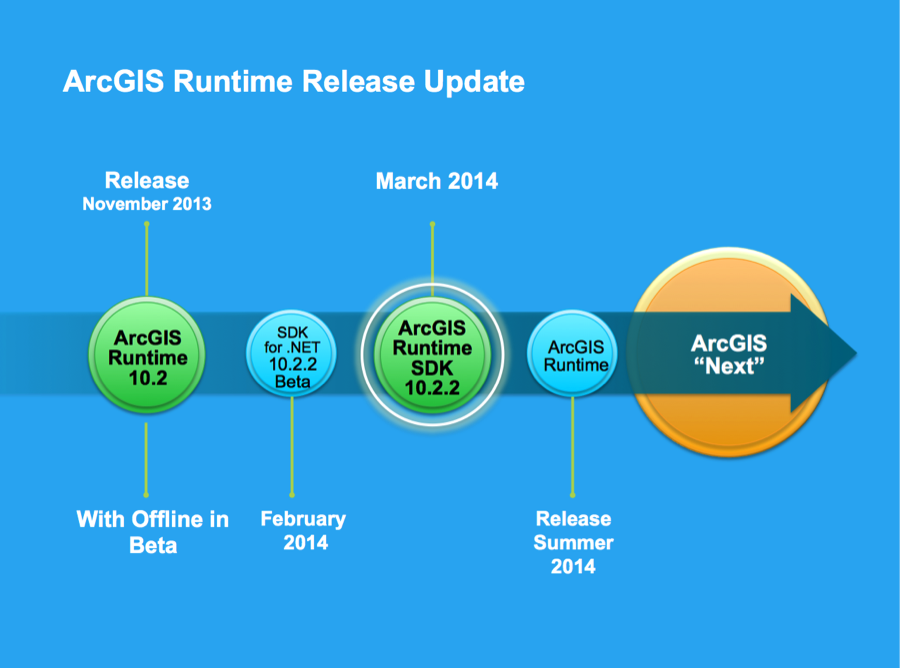
Get ready for Arcgis Runtime 10.2.2

By Lurker,


You may have heard plans for a 10.2.1 release of the ArcGIS Runtime SDKs. Well, release dates for pieces of the ArcGIS platform have shifted a bit, so the next Runtime SDK release will be version 10.2.2. This shift allows the Runtime to be released with the rest of the platform and at the same time as 10.2.2 versions of ArcGIS for Desktop, ArcGIS for Server and ArcGIS Online.
This is an exciting release for us that brings along significant capabilities you’ve been asking for:
License Change
Draganflyer 4 Blade Copter and Draganfly Tango UAV
By spazzle,


Great Drones
Models available:
The Draganflyer Guardian,The Draganflyer X6,The Draganflyer X4-P, The Draganflyer X4-ES and The Draganflyer Tango UAV.
Draganflyer X4-ES & X4-P - Four Blade Copter
New Aerial System to Capture Accurate Aerial Imagery Draganfly Innovations, Canada, has partnered with Pix4D, Switzerland, to combine the value of a Draganflyer sUAS (small Unmanned Aerial System) with the Pix4D software package. This results in a system capable of capturing highly a
Professional user help is needed_Buildings shades
By whocares1980,
Hi All,
I have building footprints with height info. I also have sun elevation (angle) and sun azimuth. How can I model the shades for buildings and extract them???
There is a model in ArcGIS but it is for DEM data.
Thanks
WhoC
-
Forum Statistics
8.7k
Total Topics43.4k
Total Posts


