- 0 replies
- 1,137 views
- Add Reply
- 0 replies
- 1,251 views
- Add Reply
- 0 replies
- 1,133 views
- Add Reply
- 3 replies
- 2,758 views
- Add Reply
- 1 reply
- 1,665 views
- Add Reply
Sokkia introduces NET AXII measuring station

By Lurker,


Sokkia announces the release of the latest edition to its line of high-accuracy measuring stations — the NET AXII. Designed for precision-intensive tasks such as monitoring, bridge construction, and other highly detailed engineering projects, the NET AXII series is a fully robotic total station solution.
The series includes the NET1 AXII and the NET05 AXII with 1” angle accuracy and 0.5” angle accuracy, respectively. “NET1 AXII is an excellent choice for long distance measurements, and NET
Topcon announces latest addition to 3-D layout line

By Lurker,


Topcon Positioning Group announces an update to its world’s first line of 3-D positioning systems designed for one-operator layout – the LN-100W. The latest model includes Bluetooth® functionality.
“LN-100W offers an enhanced level of connectivity with the addition of Bluetooth functionality,” said Ray Kerwin, Topcon director of global surveying products. “Now operators have an additional wireless communication option that will provide greater versatility with devices such as tablets that
CARIS releases HIPS and SIPS 9.0 and Bathy DataBASE 4.1

By Lurker,
CARIS is pleased to announce new releases of its hydrographic data processing and bathymetric data management and analysis solutions. The latest releases of HIPS and SIPS 9.0 and Bathy DataBASE 4.1 feature significant enhancements, as well as providing streamlined connectivity and smart utilization of shared functionality. HIPS and SIPS 9.0 The release of HIPS and SIPS 9.0 brings the leading hydrographic data processing system into the next generation. With over 20 years of development, the la
Trimble Introduces eCognition Essentials Software for Geospatial and Remote Sensing Professionals

By Lurker,
Trimble (TRMB) announced today eCognition® Essentials, a new software solution for geospatial and remote sensing professionals performing land cover mapping tasks using satellite imagery. eCognition Essentials offers an intuitive image analysis solution that allows users of all levels to quickly produce high-quality, Geographic Information System (GIS)-ready deliverables.
Leveraging core eCognition software technology, eCognition Essentials is easy to use with its simplified and intuitive inter
Sneak Peak QGIS 2.6

By Lurker,


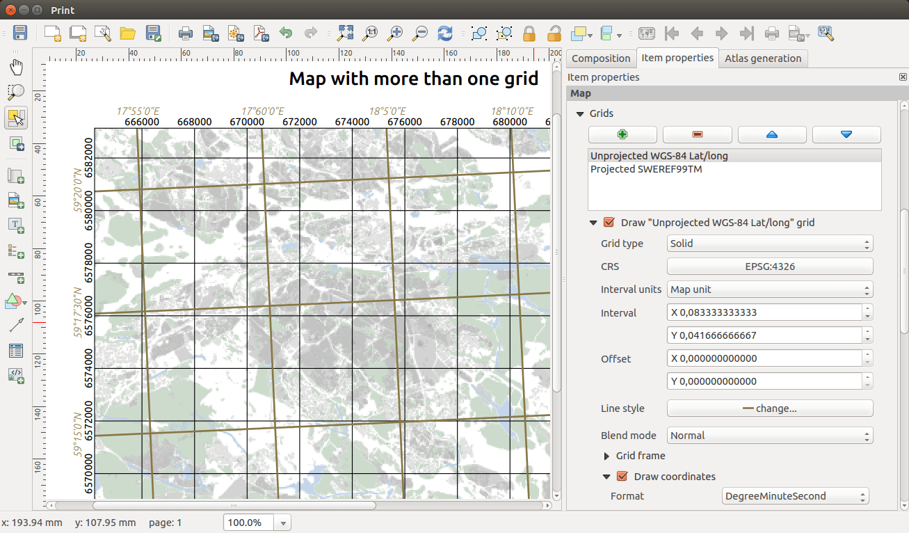
Independent Grid (Print Composer)
Grids in the print composer can now be added independent of the projection of the map, and you can add as many grids you could possibly want.
Colour Picker
The standard colours can be edited in the settings ( Settings – Options ). Not only can you add and remove colours, you can also name them to your content. Your personal standard colours can then be shared by import/export functions (GIMP Palette *.gpl).
Python Parser
-
Forum Statistics
8.7k
Total Topics43.4k
Total Posts


