- 0 replies
- 1,963 views
- Add Reply
- 0 replies
- 1,394 views
- Add Reply
- 0 replies
- 2,173 views
- Add Reply
- 1 reply
- 1,277 views
- Add Reply
- 0 replies
- 1,122 views
- Add Reply
USDA Certifies CompassData’s CompassTA™ Elevation Verification Software

By Lurker,
CompassData, a worldwide provider of geospatial data and services, announced that its CompassTA™ elevation accuracy software has received OCIO-ITS certification from the U.S. Department of Agriculture (USDA). Certification allows 40,000 USDA users the opportunity to utilize CompassTA software for elevation accuracy verification of LiDAR point clouds, digital elevation models (DEM), and other raster data sets.
“This certification provides assurance to our current and future USDA clients th
Esri Maps for MicroStrategy 2.0 Released

By Lurker,
We are pleased to announce the release of Esri Maps for MicroStrategy 2.0.
This release of Esri Maps for MicroStrategy offers improvements and fixes in several areas such as the following:
New Esri Maps for MicroStrategy Mobile app
New tool for automatic map generation: Location Architect
Support for disconnected Portal for ArcGIS deployments
New drawing tools for triggering configured selectors and links
Filter features that are displayed on the map using the Fil
GIS 2go: New app for Offline access to ArcGIS maps from tablets

By Lurker,
With GIS 2go, Disy has developed a solution that allows GIS users to take their own maps along on a tablet (Android or iPad) or make them available to other users via the cloud. Instead of a laptop, users can take the handier and cheaper tablet with them to the field. Basic GIS functions, such as viewing, redlining and geometry editing, are now also available offline, so without an internet connection required.
Setting individual editing options
The new functions are available from now on t
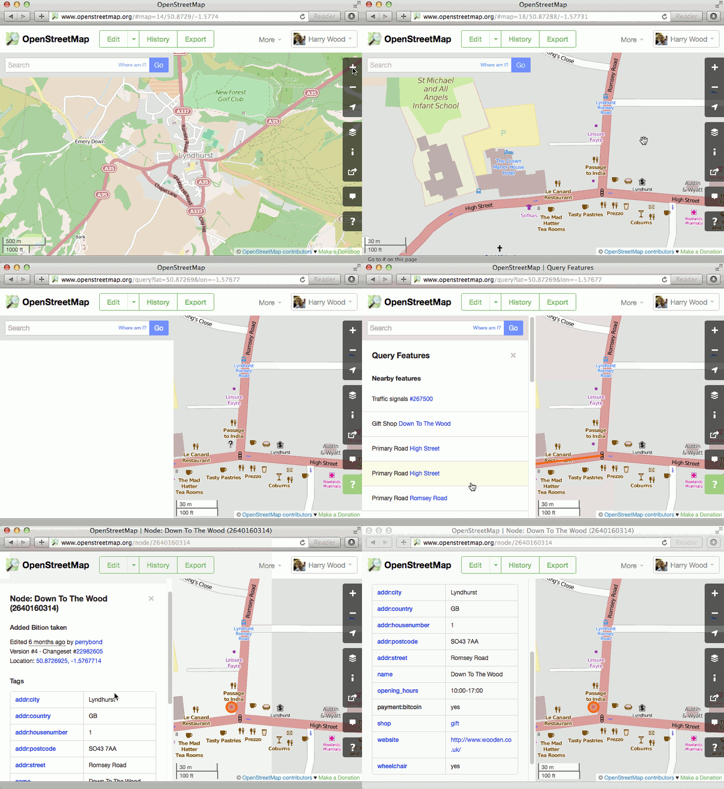
New query feature on openstreetmap

By Lurker,


A couple of weeks ago we mentioned a brand new feature on the OpenStreetMap.org homepage. On the right hand side we have a new “?” button which lets you query the map.
On openstreetmap.org, zoom in somewhere
Click the “?” button to enter query mode
Click the map on something you are interested in
Hover over the results, and choose one to find out more
When you query a spot on the map, this new tool will retrieve nearby points of interest from the OpenStreetMap dat
Optech announces Titan, the world’s first multispectral airborne lidar sensor

By Lurker,


Optech is pleased to announce the latest addition to its innovative line of airborne laser terrain mappers (ALTM), the Optech Titan, launching a new era in remote sensing. For the first time ever, multispectral active imaging of the environment can occur day or night, enabling new vertical applications and information extraction capabilities for lidar.
In the past, single or dual-wavelength sensors were developed for specific market verticals and application requirements. Titan breaks away f
-
Forum Statistics
8.7k
Total Topics43.4k
Total Posts


