- 0 replies
- 1,756 views
- Add Reply
- 0 replies
- 1,213 views
- Add Reply
- 2 replies
- 3,797 views
- Add Reply
- 2 replies
- 1,738 views
- Add Reply
- 2 replies
- 1,303 views
- Add Reply
data interoperability tool for arc 10.3
By veegee,
Please any one share me how to install data interoperability tool for arcmap 10.3 version. The extension i have installed is not working.
Thanks.
Compatibility of GIS and GNSS Master Level Qualification
By engineerup,
Hi folks,
I have a background in civil engineering and have been actively working in GIS field for last several years after acquiring a postgraduate qualification in GIS. As my work is mostly concerned with LBS and mobile mapping, I have gradually realized the importance of different GNSS solutions and can also see the rapid expansion in this field.
I wanted to take some certificate level courses in GNSS hardware / software as well as its utility from RS point of view, but t
Annotation convert to Shape file
By mateen330,
Please to inform that how can convert / create DGN Annotation to Shape File ARCMAP 10.1 ?
What is the steps / procedure
Regards
Mohd
Google Map Maker is in Rest

By msig0000,


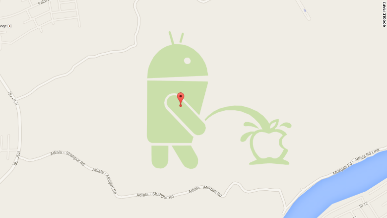
Google has temporarily suspended Google Map Maker, a service to allow the community to make edits to Google Maps similar to how Wikipedia edits work. The reason the service was suspended was because of the recent public edits made to show how easy it is to make fraudulent edits to businesses.
Google has pulled the tool that allowed users to make amendments to its Maps service, in the wake of a huge prank that saw a user draw the Android logo urinating onto the Apple one.
More
Recrop multiple Images (stereo) from UAV flights
By agraham1,
Hi All,
I am working with two cameras taking stereo images, one camera is 3 band and the other is one band. I triggered the cameras to capture at the same time, but there is obviously a slight offset in the photo field of view when comparing each camera. So I would like to crop the images so they cover the same FOV, so ultimately I would be able to stack the images in 4 bands.
Is there any way using erdas or some other software where I could do this quickly for hundreds of photos?
-
Forum Statistics
8.7k
Total Topics43.4k
Total Posts


