- 4 replies
- 2,512 views
- Add Reply
- 5 replies
- 1,602 views
- Add Reply
- 0 replies
- 1,330 views
- Add Reply
- 0 replies
- 2,497 views
- Add Reply
- 0 replies
- 1,497 views
- Add Reply
Free GIS apps?
By GISmo,
I searched GIS in the apple app store and received a never ending list of free GIS apps, all of which seemed very similar.
Are some better than others?
Are any of them actually "free" are do they have hidden costs associated with them?
What advantages would you get with a paid GIS app?
Any advice would be greatly appreciated!
Sea surface tempreture of landsat images using ENVI

By am2,
Hi,
Can some one gives me a good method to estimate sea surface tempreture using landsat images?
Thank you
Fuzzy c-mean and k-mean in terrset

By am2,
Hi,
Does any one know how to run fuzzy c-mean and k-mean in terrset?If there is any kind of tutorial it would be great,
Thanks
Weighted Overlay Analysis Tool
By engineerup,
Hi folks,
I am trying to build a standalone GIS application in python which should be solely based upon free and open source libraries / packages and does not have any dependency on the software packages like ArcGIS or QGIS.
One of the analysis functionality which I need to incorporate is the weighted overlay analysis. Now, understandably the same can be easily done in ArcGIS or QGIS or by developing addins for them, but have no experience with how to do it with other open sour
CartoDB launches One-Click Mapping

By Lurker,


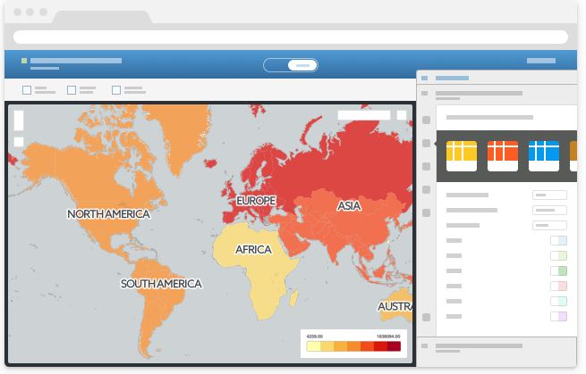
CartoDB One-Click Mapping has landed. CartoDB already let you jump from dataset to shareable, web-based data visualizations in a matter of seconds. With One-Click Mapping, that jump is even shorter.
From now on, our brand new functionality will analyze your uploaded datasets and make suggestions of columns to visualize, offering you a selection of ready-made maps from the moment you click over to the dashboard. The platform will now give you a variety of sample maps to choose from, tailored
-
Forum Statistics
8.7k
Total Topics43.4k
Total Posts


