- 0 replies
- 1,253 views
- Add Reply
- 0 replies
- 1,763 views
- Add Reply
- 2 replies
- 1,202 views
- Add Reply
- 0 replies
- 1,311 views
- Add Reply
- 0 replies
- 1,610 views
- Add Reply
Geospatial World Forum 2016

By Lurker,


Conference :
Now in its 8th edition, Geospatial World Forum has gained a repute of being a not-to-be-missed conference for the professionals engaged in geospatial sector and its application domain. It is the most premium global platform for geospatial community and offers the best opportunity for learning, sharing, connecting, branding and networking with senior decision makers associated with geospatial world. The conference aims at enriching the geospatial ecosystem with market intelligenc
Web Map Application - Zika Map

By Lurker,
Interesting application of GIS for Zika mapping
links :
http://www.healthmap.org/zika/#timeline
HealthMap is a Linux/Apache/MySQL/PHP application and relies on the following open products.
Google Maps GoogleMapAPI for PHP Google Translate API xajax PHP AJAX library
HealthMap also uses Fisher-Robinson Bayesian filtering, as described by Gary Robinson in A Statistical Approach to the Spam Problem.
HealthMap's content is aggregated from freely available informatio
Happy 10th Birthday OSGeo Foundation

By Lurker,


4th of February is a great day for all of us as it was the day when our Foundation was founded. 2016 is more special as we have completed 10 Years. No matter what yardstick one uses, it would be hard to deny that we have made great progress and our achievements have been even exceeded our own expectations. Our projects have grown more stable and robust, our events have spread worldwide, our vibrant community continues to grow, our education outreach is blooming through the collective effervescen
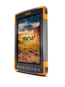
Juniper Systems to Exhibit New Windows 10 Mesa 2 Rugged Tablet™

By Lurker,


the Mesa 2 Rugged Tablet is built to perform reliably in any type of environment, and is the only Windows tablet on the market with complete IP68-rated protection against dust and water. Because it runs on Microsoft®’s new Windows 10, the Mesa 2 can be used with a wide variety of software and apps, and allows for an easy transition from field data collection to office work.
The Mesa 2 Rugged Tablet also features a 7-inch IllumiView™ display, which utilizes specialized technology to provide e
Mobile Mapping: A Game-Changer in Construction
By ptapken,
For the past decade, static lidar (or laser scanning) has been used on construction sites to effectively monitor and provide spatial data for analysis of critical construction components. The term static typically refers to tripod-mountedinstruments such as a Total Station or ILRIS-3D. Thesedevices, while highly useful, have specialized utility and are therefore limited to specific functions.
View the full case study here.
-
Forum Statistics
8.7k
Total Topics43.4k
Total Posts


