- 0 replies
- 2,342 views
- Add Reply
- 1 reply
- 1,404 views
- Add Reply
- 8 replies
- 3,448 views
- Add Reply
- 17 replies
- 9,416 views
- Add Reply
- 2 replies
- 2,196 views
- Add Reply
Bing Maps V8 Web Control Released and Deprecation Plan

By Lurker,


Two and a half months ago, at the Microsoft //Build/ Conference, the Bing Maps team announced the preview release of the Bing Maps V8 web control. Since then, the team has been working hard fixing bugs, adding new features and support for mobile, and making the Bing Maps V8 control stable and ready for production. Today we are happy to announce that Bing Maps V8 control has graduated from preview and is ready for use in production applications. The Bing Maps V8 control reduces development time
ESRI CityEngine 2016
By mandarbgis,
Hi all.
Welcome, Build Smart 3D Cities in CityEngine 2016 !!!
http://www.esri.com/esri-news/releases/16-2qtr/build-smart-3d-cities-in-minutes-with-gamechanging-esri-cityengine-2016
Remote Sensing and GIS Tutorial
By ajaysbharadwaj,
Hi All, I am a Doctorate in Remote Sensing and GIS. I have created an online tutorial Geospatial Technologies primarily concentrating on practical aspects both for beginners and for advanced learners. I am sure this will be useful for the members. Please have a look at the following link. https://www.youtube.com/channel/UCK-8Ky7ZiohkOrHpe6EM1Lw Tutorials are totally free of cost and created just out of passion to help students and professionals in the field of Geospatial Technologies.
extraction of built-up area from images

By imtest133,
Dear all
I'm new in remote sensing and I have problems when try to extract built-up area from an image or during image classification.
I am using landsat 7 ETM+ and TM images, when I use supervised or un-supervised methods for image classification, urban area (built-up area) are not recognizable from bare-soil.
I read several papers about built-up Indexes and tried some of them but there is no tangible improvement in results.
Please guide me as step by step process.
Regards
Online Cartography with multiple satellite imagery

By intertronic,


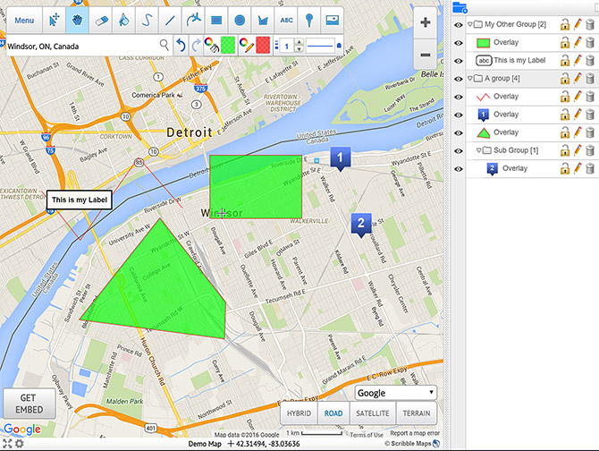
Hi, I just want to share this site for online cartography
https://www.scribblemaps.com/
here if you want to try to directly create the map
https://www.scribblemaps.com/create/
it's a simple but quite powerful site where you get satellite imagery (google and bings), maps and you can draw features over it. The online tool gives you the opportunity to change design and style of the background and to digitalize some polygons, points etc. The software gives you the ability to import
-
Forum Statistics
8.7k
Total Topics43.4k
Total Posts


