- 2 replies
- 2,893 views
- Add Reply
- 1 reply
- 2,274 views
- Add Reply
- 0 replies
- 2,132 views
- Add Reply
- 2 replies
- 7,587 views
- Add Reply
- 0 replies
- 1,594 views
- Add Reply
How can i train a deep learning model to extract the building footprint

By Yasser,
I’am a Geomatics student and i want to train a deep learning model to extract the building footprint of a city, how can i do it ? It is easy to do for Geomatics or survey engineer ? Or this project need to IT background ?
thanks
QGIS shows different coordinates than Google Earth for the same location...

By hnaudr,
Hi friends !
In QGIS 3.32.2, I am using WGS 1984 EPSG 4326 for both Project and Basemap of Google Satellite Hybrid.
When I use Google Earth Pro on Desktop and locate my home, the coordinates are: 24.590580°, 73.719466°
BUT... when I navigate to my home location in Basemap of QGIS and capture coordinates with Lat-ong tool II get these values: 2825537.85691968, 8206411.02187792
Why is QGIS not showing coordinate values as Google Earth? How to convert latitude and longitude valu
IBM and NASA teamed up to build the GPT of Earth sciences

By Lurker,
The open-source model will serve as the basis for future forest, crop and climate change-monitoring AI.
NASA estimates that its Earth science missions will generate around a quarter million terabytes of data in 2024 alone. In order for climate scientists and the research community efficiently dig through these reams of raw satellite data, IBM, HuggingFace and NASA have collaborated to build an open-source geospatial foundation model that will serve as the basis for a new class
How to modify color of imported SVG icons in QGIS

By instrutorgis,
Hello friends!
I have plant symbols and would like to use them in QGIS. The problem is that these symbols don't allow you to edit the background colors.
https://drive.google.com/file/d/15n7TvSRx8Ha2Igm_rs13A8KVggsSghJs/view?usp=sharing
I followed jbrocha's solution posted on the GIS Stack Exchange forum:
https://gis.stackexchange.com/questions/45180/how-to-create-svg-symbols-that-have-modifiable-fill-color-stroke-color-and-stro
However, I would like to know if there is a more pr
Esri updates Land Cover Explorer app

By rahmansunbeam,
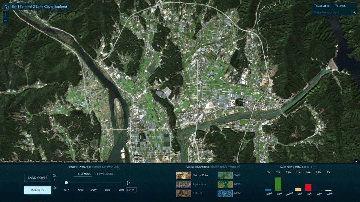
With the onset of the this years User Conference, Esri unveiled various updates to its existing services and apps, one of which is the Sentinel-2 Land Cover Explorer announced in last February. You can also find this in the Living Atlas. Apart of the the visual updates, the biggest change this time is that the changes over the year are now more accurate.
A fundamental aspect of global LULC maps is the ability to detect and assess land cover changes over time. Improving on an already accurat
-
Forum Statistics
8.8k
Total Topics43.5k
Total Posts
-
Latest Posts
-
 Are you ready to level up your geospatial skills? Join our comprehensive training course covering ArcMap, ArcGIS Pro, and ArcOnline—the essential tools for modern spatial analysis and programming! What You’ll Learn: Core functionalities of ArcMap & ArcGIS Pro Cloud-based mapping with ArcGIS Online Automating workflows with Python & ModelBuilder Creating interactive web maps & apps Who Should Enroll? GIS beginners & professionals Urban planners, environmental scientists, & data analysts Developers looking to integrate spatial programming Why Choose This Course? Hands-on projects & real-world applications Expert-led sessions & flexible learning Limited slots available! Click here to register. Let’s shape the future of spatial data together!
 -
GPS is an incredible piece of modern technology. Not only does it allow for locating objects precisely anywhere on the planet, but it also enables the turn-by-turn directions we take for granted these days — all without needing anything more than a radio receiver and some software to decode the signals constantly being sent down from space. [Chris] took that last bit bit as somewhat of a challenge and set off to write a software-defined GPS receiver from the ground up. As GPS started as a military technology, the level of precision needed for things like turn-by-turn navigation wasn’t always available to civilians. The “coarse” positioning is only capable of accuracy within a few hundred meters, so this legacy capability is the first thing that [Chris] tackles here. It is pretty fast, though, with the system able to resolve a location in 24 seconds from cold start and then displaying its information in a browser window. Everything in this build is done in Python as well, meaning that it’s a great starting point for investigating how GPS works and for building other projects from there. The other thing that makes this project accessible is that the only other hardware needed besides a computer that runs Python is an RTL-SDR dongle. These inexpensive TV dongles ushered in a software-defined radio revolution about a decade ago when it was found that they could receive a wide array of radio signals beyond just TV. source: Hackaday and GitHub - chrisdoble/gps-receiver
-
-

-
-
Latest Topics
-
-
Recent Achievements
-


")


